Buying High-Resolution Satellite Imagery in the Middle East
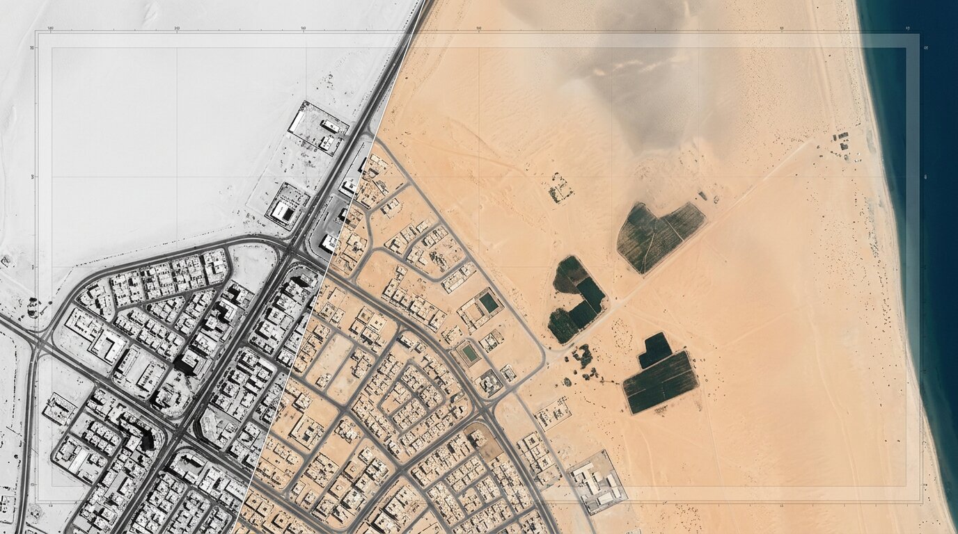
Procuring very high resolution imagery across the Gulf and the wider region looks like a straightforward comparison of numbers on a specification sheet. Three things complicate it in practice, and only one of them appears on the sheet.
The number on the datasheet is two numbers
Very high resolution products are almost always fused. A panchromatic band collects at the headline ground sample distance, the multispectral bands collect at a coarser one, and pansharpening merges the two into a colour image carrying the panchromatic geometry.
That merge is legitimate and universal, and it does not create spectral fidelity at the sharper scale. A pansharpened 50 cm product is 50 cm panchromatic fused with multispectral collected at around 2 metres, so the colour information in those pixels was interpolated rather than measured. For visual interpretation, base mapping, and feature digitisation this makes no practical difference. For anything index-based, the distinction is the whole ballgame, because a vegetation or built-up index computed on interpolated colour inherits the interpolation.
Which providers publish native figures rather than fused ones varies more than expected, and Sebastian Holt's eight-provider comparison sets the high-resolution satellite imagery providers side by side on exactly that point, including whether a stated resolution is native or processed.
Three questions settle it with any vendor, and all three deserve written answers.
|
Question
|
Why it matters
|
|
What is the native panchromatic GSD?
|
This is the real geometric resolution of the product
|
|
What is the native multispectral GSD?
|
This sets the limit for any spectral analysis
|
|
Is the delivered product pansharpened, resampled, or native?
|
Resampled products carry a finer pixel size than the sensor collected
|
Resampled products are the trap in that list. A file delivered on a 30 cm grid may have been upscaled from a coarser collection, and nothing in the file itself announces that.
One rule that applies here and nowhere else
A regulatory constraint specific to this region shapes what US vendors may sell. Under the Kyl-Bingaman Amendment, Section 1064 of Public Law 104-201, the US Department of Commerce must limit the resolution of commercial imagery with respect to Israel to what is already commercially available from non-US sources.
The limit stood at 2.0 metres for more than two decades. In July 2020 the Department published a finding that non-US sources were supplying 0.4 metre imagery, and revised the cap to 0.4 metres GSD accordingly. The Office of Space Commerce states that the finding is reviewed as further evidence of commercial availability emerges.
For procurement the operative point is the asymmetry. The rule binds US licensees, and non-US operators were never subject to it, so archive holdings over the same ground can differ in resolution depending on which operator collected them and in which year. A buyer comparing archive catalogues in this region is therefore comparing regulatory histories as much as sensor capabilities.
Acquisition conditions favour this region
The standard tasking caveat about cloud cover carries much less weight here than almost anywhere else. Low cloud frequency and consistent solar geometry make optical tasking unusually reliable across most of the year, and the failed-acquisition risk that dominates tropical and high-latitude programmes stays comparatively small.
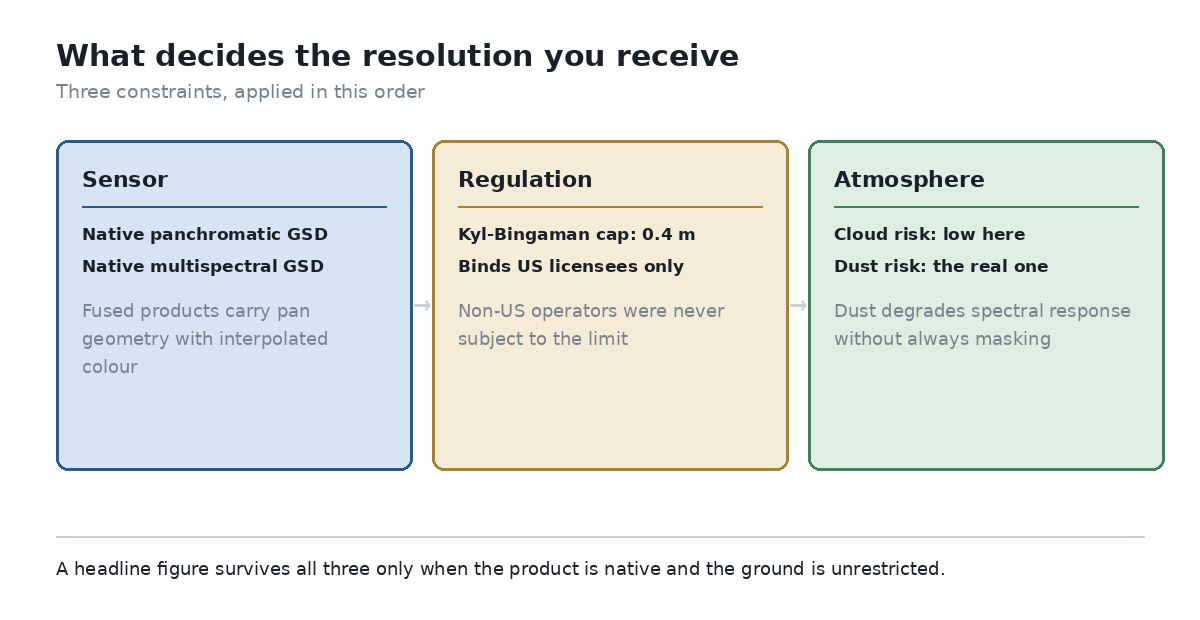
The three constraints that decide what a buyer in the region actually receives. Source: own diagram, based on published sensor specifications and the Department of Commerce finding.
Dust is the substitute risk, and it behaves differently from cloud. Suspended dust does not always trigger a cloud mask; it degrades contrast and shifts spectral response, so an acquisition can pass quality screening whilst being unusable for spectral work. Where a programme depends on index values, dust conditions belong in the acceptance criteria alongside cloud percentage.
What this means for a base-mapping programme
Municipal base mapping, cadastre updates, and utility inventory work sit almost entirely in the visual-interpretation category, which is the comfortable case.
- For visual and cartographic work, a pansharpened product is fine, and the panchromatic GSD is the number that matters
- For any index-driven analysis, ask for native multispectral rather than fusedoutput, and expect a coarser pixel
- Where archive continuity matters, check which operator collected each epoch, since regulatory limits applied unevenly
- For tasking, negotiate acceptance criteria that name dust as well as cloud, because only one of them is standard
- Where budgets are tight, remember that a coarser native product often beats a finer resampled onefor measurement
Those five points reorder a shortlist reliably, and none of them requires a new procurement process.
The comparison worth making
Delegates at the geospatial sessions once held here, including the leadership forum and the accompanying ISPRS programme, were already debating resolution against fitness for purpose when 60 cm counted as very high resolution. Native satellite resolution has roughly doubled since then, and the underlying question stands unchanged.
What a buyer receives is set by three things: what the sensor natively collected, what regulation permits for that ground, and what the atmosphere allowed on the day. A comparison built on those three answers holds up considerably better than one built on the headline figure alone. |